Forum content is readable by default! Create an account and log in to add posts or topics.
GPS DriftCast
oliverhub@oliverhub
24 Posts
#1 · February 26, 2025, 9:17 am
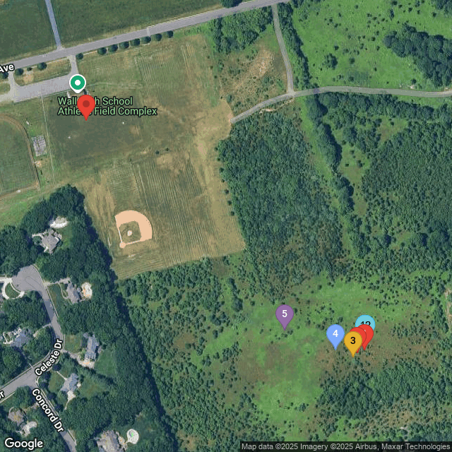
Quote from oliverhub on February 26, 2025, 9:17 amI wanted to share my experience with the website GPSDriftCast.com. I used the decimal GPS coordinates of 40.163051 and -74.082315 for the Wall field launch site and waiver. The following map was generated for March 2 for a 900' apogee flight.
I guess I will need to reduce altitude if I want to recover my rocket(s) let alone land on the field. LOL
I wanted to share my experience with the website GPSDriftCast.com. I used the decimal GPS coordinates of 40.163051 and -74.082315 for the Wall field launch site and waiver. The following map was generated for March 2 for a 900' apogee flight.
I guess I will need to reduce altitude if I want to recover my rocket(s) let alone land on the field. LOL
Uploaded files:Click for thumbs down.0Click for thumbs up.2
Zielijo1 and Eric Becher have reacted to this post.
Zielijo1Eric Becher
Several CENJARS Forums are only available or visible to CENJARS members.

